1 Topography
50sqkm is an experimental digital atlas that explores the complexity of place through cartography. Each map presents a different aspect of the same place: a 50-square-kilometre area of particular geopolitical significance.
Every map is the result of careful research, combining information from multiple sources with an extended design process, aiming to create a geographical encyclopedia. Together, the maps tell the story of the area as an intersection of natural, social, historical, and political conditions. Visitors are invited to explore the atlas, consider the relationships it reveals, and respond.
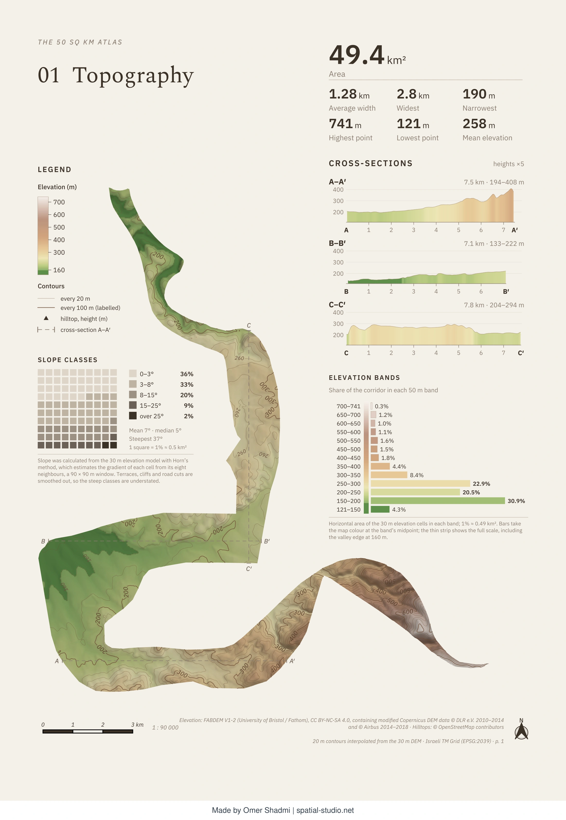 View full map
This is the first map of the 50sqkm atlas, a project aiming to study a specific area of unique geopolitical significance through cartography. The first map shows the area’s most basic conditions – it’s topography. The area is a narrow corridor whose general direction is north south. Mostly hilly – except for the edge of a wide valley at its central part. Historically, the terrain and slopes make the area not ideal for human settlement due to difficult access, especially in the southern part that rises to above 700 meters above sea level in steep slopes. On the other hand, the valley allowed the cultivation of grains, the basis of the local diet, and the hills are suitable for the cultivation of vines and olives. The valley separates the two hilly areas and allows movement of animals, people, and vegetation in an east west direction.
Comments
If you recognise the mapped area, please do not identify it in a comment.
Send a comment by email